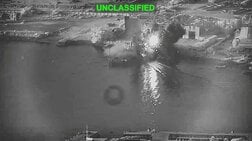
【動画】SWOTの海底地形マッピングで明らかになった「丸裸の地球」
We have better maps of the Moon's surface than we do of the bottom of the ocean.
— NASA JPL (@NASAJPL) March 19, 2025
But the SWOT satellite, designed to measure surface water and ocean topography, recently published one of the most detailed maps yet of the seafloor. https://t.co/Tr0YeUCB35 pic.twitter.com/HxTjdgWkcU

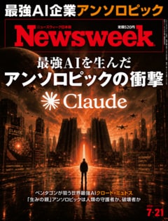
2026年7月21日号(7月14日発売)は「最強AIを生んだ アンソロピックの衝撃」特集。
ペンタゴンが狙う世界最強AIクロード・ミュトス。「生みの親」アンソロピックは人類の守護者か、破壊者か
※バックナンバーが読み放題となる定期購読はこちら
※画像をクリックするとアマゾンに飛びます